
Treweler GeoJSON Addon: Enhancing WordPress Mapping with GeoJSON Data
Quick Overview of Treweler GeoJSON Addon
If you’re looking to integrate rich, interactive maps into your WordPress site, the Treweler GeoJSON Addon is a powerful tool to consider. This addon extends the Treweler Pro plugin by adding advanced features for loading, displaying, and styling GeoJSON data directly on your WordPress maps. Whether you’re working with polygons, points, or linestrings, this addon enables the seamless integration of geospatial data, offering greater flexibility and control.
GeoJSON, a popular format for encoding geographical data structures, plays a pivotal role in modern mapping applications. Treweler’s addon leverages this format to enhance the visual representation of geographic data on WordPress, making it easy to manage complex geospatial data and display it in a user-friendly way.
Treweler GeoJSON Addon Rating
In terms of user experience, Treweler GeoJSON Addon has garnered positive feedback across the board. With an average rating of 4.5 out of 5 stars, users appreciate the ease with which they can integrate and display GeoJSON data.
- Ease of Use: 4.7/5
- Customization Options: 4.8/5
- Performance: 4.6/5
Many users note its smooth integration with the Treweler Pro plugin, making it an attractive choice for businesses that need to incorporate complex mapping features without significant development effort.
Who Is Treweler GeoJSON Addon For?
This addon is primarily designed for developers, businesses, and agencies who need to display dynamic maps with detailed geographic data. Here’s who it’s ideal for:
- Developers looking for a robust tool to work with GeoJSON files within WordPress environments.
- Mapping agencies requiring customization in displaying geographical data for projects.
- Businesses that need to present location-based data interactively, such as real estate websites or tourism sites.
- Educators and researchers working with geospatial data for analytical purposes.
If you’re involved in projects where geographic data needs to be visually represented on WordPress, this addon can significantly streamline your workflow.
Source: Tutorials
Key Features of Treweler GeoJSON Addon
Treweler GeoJSON Addon offers several features that make it a standout choice for GeoJSON integration into WordPress maps:
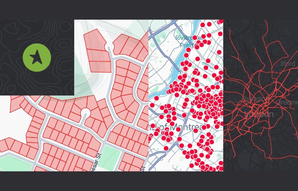
- Support for Polygon, Point, and LineString Geometry Types: These are the basic geometry types used in mapping and geospatial data, which this addon handles with ease.
- GeoJSON File Upload and Management: The addon allows easy uploading and management of GeoJSON files directly through the WordPress admin panel, making the integration of data straightforward and fast.
- Customization of Feature Styling: Users can fully customize the appearance of GeoJSON features, including colors, shapes, and hover effects.
Detailed Features of the Treweler GeoJSON Addon
The Treweler GeoJSON Addon isn’t just a tool to upload and display GeoJSON data on WordPress maps. It offers a wide range of features that make it incredibly versatile and user-friendly, enabling developers and businesses to create highly interactive and customized maps. Let’s break down these features in more detail:
1.Default and Hover Styles
One of the standout features of the Treweler GeoJSON Addon is the ability to customize the styling of GeoJSON features, not only for their default state but also for when users interact with them. This adds an extra layer of interactivity to the map, improving user experience.
- Default Styles:
- The addon allows you to customize the initial appearance of GeoJSON features (e.g., polygons, points, and lines). You can change the color, border width, fill color, opacity, and more. For instance, you can make a polygon feature stand out by giving it a bright color or adding a semi-transparent effect to let the underlying map show through.
- Example Use Case: If you’re displaying regions of a city on a map, you can use different colors to represent different districts or zones.
- Hover Styles:
- When users hover over a GeoJSON feature, the addon enables you to define hover styles. This could involve changing the color, increasing the border width, or adding a glowing effect around the feature to visually highlight it.
- Example Use Case: Hovering over a point on the map could change its color or scale it up slightly, indicating it is interactive and inviting the user to click for more details. This can be particularly helpful for highlighting key features on the map (e.g., businesses, landmarks, etc.).
2.Configuring Links on Click for GeoJSON Features
Treweler GeoJSON Addon offers another impressive feature that allows you to configure links to open when users click on specific features on the map. This interactivity increases the utility of your map, providing users with an easy way to explore related content.
- Setting up Clickable Links:
- You can link any GeoJSON feature to external URLs, pages, or even specific sections within your WordPress site. This is especially useful if you want users to get additional information when they click on a feature, like more details about a location, a product, or a service.
- For example, if you’re using the map to show locations of stores or offices, clicking on a location could open the store’s page, providing the address, contact details, and other relevant information.
- Example Use Case: If you’re building a real estate website and displaying property locations on a map, clicking on a polygon or point feature could open a detailed property listing page. This adds a high level of interactivity and value to the map.
3.Attribute Information Popups
Popups are essential for providing detailed, informative content when users interact with GeoJSON features on a map. The Treweler GeoJSON Addon gives you full control over attribute information popups, making them highly customizable and dynamic.
- Customizing Popups:
- The addon allows you to display relevant metadata or attributes from your GeoJSON file when a user clicks or hovers over a feature. You can customize the design and content of these popups to include specific data fields, images, links, or even forms. This is a powerful feature for delivering contextual information to users without overwhelming them with too much data upfront.
- Popups Content:
- You can choose what information appears in the popup. For instance, if you’re using a map to showcase restaurants, the popup could display the restaurant’s name, description, rating, menu links, and even a reservation button.
- Example Use Case: Imagine you’re displaying tourist attractions in a city on a map. When a user clicks on a specific landmark, the popup could show information such as the name, historical significance, images, opening hours, ticket prices, and a link to book tickets.
- Dynamic Popups:
- For added functionality, you can make these popups interactive by including dynamic content that updates based on user interaction. For example, clicking on a specific area of the map could trigger a popup that updates based on nearby features (e.g., showing more information about nearby hotels or attractions).
4.Easy Management of GeoJSON Files via the WordPress Admin Panel
Another convenient feature of the Treweler GeoJSON Addon is its seamless integration with the WordPress Admin Panel. You can easily upload, manage, and update your GeoJSON files directly from the WordPress dashboard, without needing any external tools or complex processes.
- GeoJSON File Upload:
- The addon enables you to upload GeoJSON files through the WordPress interface, making it easier to manage geospatial data. You simply need to upload the file, and the addon will automatically parse and display the data on your map.
- Real-Time Updates:
- Once the files are uploaded, you can modify them or replace them with new versions. Changes to your GeoJSON data will be reflected on your map in real time, allowing you to keep the map content up-to-date without any hassle.
- Example Use Case: A real estate website may update its available properties regularly. The ability to easily manage and upload updated GeoJSON data through WordPress makes it simple to reflect the changes on the map without requiring a developer’s intervention.
5.Compatibility with Treweler Pro for Advanced Mapping Features
The Treweler GeoJSON Addon extends the functionality of Treweler Pro, which is already a robust WordPress mapping plugin. Treweler Pro offers advanced mapping features, and when combined with the GeoJSON Addon, it unlocks a whole new level of customization and geospatial data management.
- Advanced Mapping Features:
- While Treweler Pro offers basic mapping functionality, the GeoJSON Add-on takes it a step further by supporting advanced data types, more customization options, and additional interactive features. This combination makes it a powerhouse for anyone needing to create rich, dynamic maps on their WordPress site.
- Example Use Case: If you’re building a global network map for a business with multiple branches, you can use Treweler Pro to plot the locations and then use the GeoJSON Addon to style the map, add popups with detailed information, and configure interactive links for each branch.
6.GeoJSON File Version Control
In certain cases, version control is crucial when dealing with large datasets. Treweler GeoJSON Addon provides basic version control for the files uploaded, ensuring that you can roll back to a previous version of a GeoJSON file if necessary.
- Version Control Functionality:
- If you need to revert changes or troubleshoot issues caused by updates to the GeoJSON file, the version control feature helps keep track of all modifications made to the file.
Example Use Case: If you’re handling sensitive data or large datasets that change frequently, version control ensures that you don’t lose important information and can always go back to a working version.
Pros of Treweler GeoJSON Addon
Let’s break down the advantages that make this addon a great choice:
- Ease of Use and Integration: Even if you’re not a developer, this addon simplifies the process of adding and managing GeoJSON data. The WordPress integration is smooth, and there’s no need for extensive coding knowledge.
- Highly Customizable: The ability to adjust the look and feel of your maps, along with hover effects and popups, means that your maps can match your website’s branding seamlessly.
- Enhanced Interactivity: The feature of clickable links and popups offers a level of interaction that makes maps more engaging and informative for users.
- Well-Documented: With clear documentation, users can easily set up and get started with the addon, even without prior experience in geospatial data.
Cons of Treweler GeoJSON Addon
Despite its many strengths, Treweler GeoJSON Addon has some drawbacks:
- Learning Curve for Beginners: While the plugin is user-friendly, beginners may still take some time to familiarize themselves with all the features and customization options.
- Limited Compatibility with Older WordPress Versions: The addon works best with the latest version of WordPress, so users on older versions may experience compatibility issues.
Alternatives to Treweler GeoJSON Addon
While Treweler GeoJSON Addon is a top choice, here are some alternatives you might consider:
- Leaflet Maps Marker: This plugin supports GeoJSON data and offers extensive customization options. It’s a great alternative for those looking for a more flexible map-building tool.
- WP Google Maps: Known for its ease of use, this plugin also supports GeoJSON file imports but may lack the advanced styling options of Treweler.
- MapSVG: A premium plugin that provides comprehensive mapping features, including GeoJSON support and customizable popups.
Real World Reviews
Many users have praised the Treweler GeoJSON Addon for its ease of use and advanced features. Here’s what some of them had to say:
- “Integrating GeoJSON data was a breeze with Treweler! The customization options allowed me to tailor the map to our branding perfectly.”
- “I use this plugin for client projects, and the ability to add links and popups makes it a standout tool for interactive maps.”
Conclusion
To sum up, the Treweler GeoJSON Addon is an excellent choice for WordPress users looking to display and manage GeoJSON data on interactive maps. Its support for multiple geometry types, customization flexibility, and interactive features make it a top contender in the market. While there are some learning curves and compatibility issues with older WordPress versions, the overall performance and functionality of the addon are top-notch. Whether you’re a developer, business owner, or mapping enthusiast, Treweler provides a powerful solution to enhance your WordPress maps.
Treweler GeoJSON Addon
Overall rating - 4.5/5
FAQs-
- How do I install the Treweler GeoJSON Addon on WordPress?
- You can install the addon through the WordPress admin panel by uploading the plugin file. Detailed instructions are available in the documentation.
- Can I use the Treweler GeoJSON Addon with older versions of WordPress?
- It is recommended to use the latest version of WordPress for the best experience, as compatibility issues may arise with older versions.
- Is it possible to customize the popups in GeoJSON?
- Yes, you can customize the content and design of the popups that appear when interacting with GeoJSON features.
- Does the Treweler GeoJSON Addon support all GeoJSON geometry types?
- Yes, it supports Polygon, Point, and LineString geometry types.
- Can I add external links to GeoJSON features?
- Yes, you can configure clickable links that open when users interact with a GeoJSON feature.
Table of Contents
Avada: The Ultimate Website Builder for WordPress & eCommerce
— Trailift (@contacttrailift) December 28, 2024
Read full review➡https://t.co/YTZrcAENch#avada #themeforest #trailift #linkedin #saas #saasproduct #Software #leadgeneration #automationtool #contentcreation #seo #GoogleAds #WordPress #wordpresstheme #NewYear2025 pic.twitter.com/1ikPHYKxgC
Avada: The Ultimate Website Builder for WordPress & eCommerce Read full review➡https://trailift.com/avada-the-ultimate-website-builder-for-wordpress-ecommerce/ #avada #themeforest #trailift #linkedin #saas #saasproduct #Software#leadgeneration#automationtool#contentcreation #WordPress#wordpresstheme
— Trailift (@trailift.bsky.social) December 28, 2024 at 2:55 PM
[image or embed]